
Search an Ingham Street by Address
The most useful Ingham street search begins with an exact address rather than a surname. It establishes a parcel and its recorded connections, not a census of occupants. Start with the county property roll, save the owner and parcel number, and use the map to make sure the result sits on the intended street segment. Recorded documents and historical directories can then add time depth. A voter record is a separate public-record channel with protected fields and should never be treated as a roster of everyone at an address.
- Enter the normalized address in Ingham County BS&A Online. Record the property or situs address, owner or taxpayer block, parcel number, and local unit.
- Open the parcel in the Ingham County Equalization Tax Mapping Viewer. Check the parcel polygon, the road, and the applicable city or township before proceeding.
- Use the parcel number and legal description to search the Register of Deeds Direct Search for the recorded chain. A deed party can be an owner, trustee, estate, or other record party.
- For a lawful voter-record question, use the individual Michigan Voter Information Center or the state request process, keeping in mind that the individual tool is not a street-wide browse.
- For earlier household evidence, use the address sections and cross-reference volumes at CADL. The city-directory collections, rather than a current property roll, are the useful historical layer.
Note: A street can cross Lansing, a township, or another local unit, so verify the assessor jurisdiction before comparing record results.
Ingham Street Directory Searches in BS&A
BS&A is the working start for a modern Ingham street directory search. Its county page exposes All Records, Assessing, and Delinquent Tax modes, and the search control switches among Address, Name, and Parcel Number. Address accepts one address or a range such as 100–200 Main St. The parcel number is the steadier key when a number has changed, while an owner-name search can help test a result found in the map. Individual local assessors maintain the current roll, so the municipality selector matters when a county view is older.
| BS&A control | Form | Use for a street search | Available detail |
|---|---|---|---|
| All Records / Assessing / Delinquent Tax | Mode selector | Choose the relevant property or tax area | Current roll and tax-related pathways |
| Address | Text search | One address or a range on a named street | Property or situs address and parcel result |
| Name | Text search | Test an owner or taxpayer name from a parcel card | Owner-name results |
| Parcel Number | Text search | Carry the stable parcel key into related records | Parcel-specific property result |
| Advanced sale search | Filter form | Narrow a property-history question | Sale date, price, grantor, grantee, class, area, year built, bedrooms, bathrooms, and neighborhood |
A parcel card can show an owner, taxpayer information, mailing address, assessed and taxable value, building facts, a sketch or image link, and tax links. Those fields document how the tax roll describes a parcel. They do not prove that the owner lives at the property.
For a view of the advanced filters, see the BS&A advanced property search screen below.
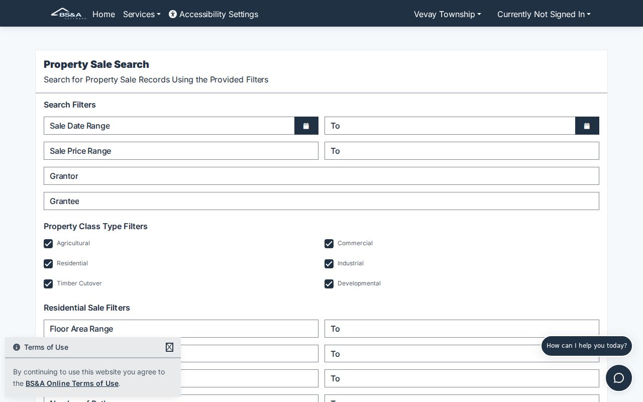
The search form is useful when an address result needs context, but the parcel number and legal description remain the bridge to a deed record.
Ingham Streets on the GIS Viewer
The Equalization Tax Mapping Viewer, created for Ingham Equalization by MSU Remote Sensing and GIS Research and Outreach Services, supplies the geographic check that a text result lacks. Search or zoom to the street, click the parcel polygon, and follow its parcel or assessment link. The viewer can provide the street segment, parcel shape, local boundaries, districts, roads, and other live overlays. Its exact controls can change, so use the current viewer rather than relying on a saved description of a button.
The Ingham GIS viewer starts the map portion of the work.
A polygon confirms the mapped parcel, not a legal boundary. Do not infer adjacent ownership from the nearest street number when an alley, corner lot, shared drive, or irregular parcel could alter the relationship.
The county's Equalization office information explains the assessment and mapping role behind the public tools.
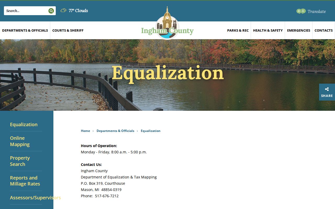
Equalization works with 16 township and five city assessors, while the local assessor is the office that changes an individual assessment.
Ingham Street Records and Their Limits
Several Ingham records can be keyed to an address, but they should be read as a chain of narrow answers. A tax roll identifies the parcel relationship. The GIS viewer places it on the ground. The Register records land instruments. Permit material dates construction or alteration. Older street sections can place a household at a number in a particular year. The records are complementary, and they carry different access channels when the online search is incomplete.
| Address record | What it can show | Ingham access path | Important limit |
|---|---|---|---|
| BS&A assessing | Owner, taxpayer, situs and mailing address, parcel, class, value, characteristics | Online address, name, or parcel search; local assessor for corrections | Current data varies by local unit |
| GIS parcel viewer | Parcel polygon, roads, adjacent parcels, and district context | Public map viewer | Reference map, not a survey |
| Recorded deeds and plats | Grantor, grantee, instrument, date, legal description, book/page or document number | Free index, paid image route, or Mason vault | Record party is not proof of occupancy |
| Tax and delinquency material | Taxpayer and tax-status trail | BS&A and Treasurer records; archives for older rolls | Verify tax-sale detail with the Treasurer |
| Lansing permits | Work address, applicant, owner, inspections, approvals, or demolition | Building Safety route or FOIA request | Public portal fields are not confirmed |
| Polk street section | Address-era occupants and businesses | CADL, MSU, and branch database access | Historical publisher record, not current proof |
For a request that cannot be answered through a public online index, Ingham County's FOIA Center is the county route for public-body records. Court records are handled through the relevant clerk rather than an ordinary FOIA request.
Ingham Street Addresses Need Two Fields
One address field can hide a critical distinction in an Ingham property result. The situs field tells where the parcel sits. The mailing field tells where a tax notice is directed. A mailing address might belong to an owner, trust, estate, corporation, attorney, bank, or tax representative. It is a contact field, not evidence that someone occupies the street address. Preserve both values exactly in a personal research note.
- Parcel
- A local-unit property identifier that links a mapped piece of land to assessment and tax information. Use the displayed Ingham format exactly.
- Situs address
- The physical property address assigned to the parcel. It answers where the land or building is located.
- Plat
- A recorded map that relates a subdivision's lots and blocks to the ground. It can connect legal language to a later street address.
- Criss-cross directory
- The reverse, address-first part of a directory that can place historical occupants or businesses at a number.
Ingham's street geography includes Lansing's grid, East Lansing, township roads, village plats, and rural routes. An address can also be associated with a postal city that differs from the tax jurisdiction. Preserve the city or township named in the assessment result instead of assuming that a mailing label settles the government geography.
Ingham Street Deed Chains and Plats
Use the parcel's legal description when moving from a street address to the Register of Deeds. A chain of title is built backward: find the present owner as grantee, locate the vesting instrument, identify the seller or grantor, then search that prior party as a grantee for the earlier acquisition. Keep the document number or book and page, recording date, instrument type, and legal description at every turn. A quitclaim, fiduciary instrument, survivorship deed, estate deed, or release can explain continuity even when no ordinary sale appears.
The Tapestry grantor-grantee search is the paid image route for many later instruments.
A deed image can contain the legal description that makes an older search possible. It is not interchangeable with the current assessor roll or a GIS parcel display.
Four Ingham Street Record Systems
It is a mistake to expect one system to answer every street question. BS&A gives current parcel and tax context. GIS gives the map context. The Register of Deeds records title instruments. Directories give an older occupant layer. Comparing them helps distinguish an owner, a recorded party, and a directory-era household without collapsing those roles into one claim.
| BS&A | Use for the current parcel number, assessment fields, and owner or taxpayer block. |
|---|---|
| GIS viewer | Use for parcel geometry, street segment, and jurisdictional context. |
| Register of Deeds | Use for the recorded land instrument sequence and legal description. |
| Address directories | Use for historical address-era occupants, businesses, and moves. |
This comparison is especially helpful on a street that passes through more than one municipality. Select the local assessor's current roll when the county-level page has not caught up.
Note: Record a source and date beside each name so a later researcher can tell an assessed owner from a historical occupant.
Ingham Street Permits and Tax Trails
Address records can also date changes to a property. BS&A's assessing and delinquent-tax services connect the owner, taxpayer, mailing address, and tax status to a parcel. A homestead exemption can be an ownership clue, but it is a tax classification that can lag a move or remain under review. Delinquency, tax-sale, or foreclosure material may mark a change in the property story, yet the County Treasurer remains the source to confirm its current status.
Lansing's permanent permit database retains work address, applicant, owner, license, inspection dates and comments, design professional, description, approvals, and demolition. A permit can date construction, alteration, or demolition. It does not establish who lived there. For an older building, compare its permit trail with the earliest directory listing, a Sanborn map, and the deed sequence.
Ingham Street Directories Before Digital
For past residents along a street, CADL's address-first material is more useful than a present-day street directory. The local city-directory sequence runs from 1867 in print, and the annual publications provide household-status information by last name and, from 1906 forward, by street address. The Polk cross-reference component is the reverse tool that turns a number or street into an older occupant name. The historical collections themselves are described in the Ingham City Directories.
Early Lansing work demands extra care. The first numbering system in Mudge's 1878 directory was used about 1867 to 1883, and early volumes can omit the modern North, South, East, and West qualifiers. Test the old number, spelling, suffix, cross streets, plat, and Sanborn index before deciding an address was absent.
Ingham Vault Work for Older Streets
Online access is useful but incomplete. The free Direct Search index reaches from 1956 to the present except for the most recent seven days. The county warns that 1956 through 1981 data is being researched for conversion discrepancies, while 1982 forward has been described as accurate. Paid Tapestry images generally begin about 1960. A critical search that crosses the seam should not end with a missing or partial online result.
The county's Direct Search route is the free index entry point.
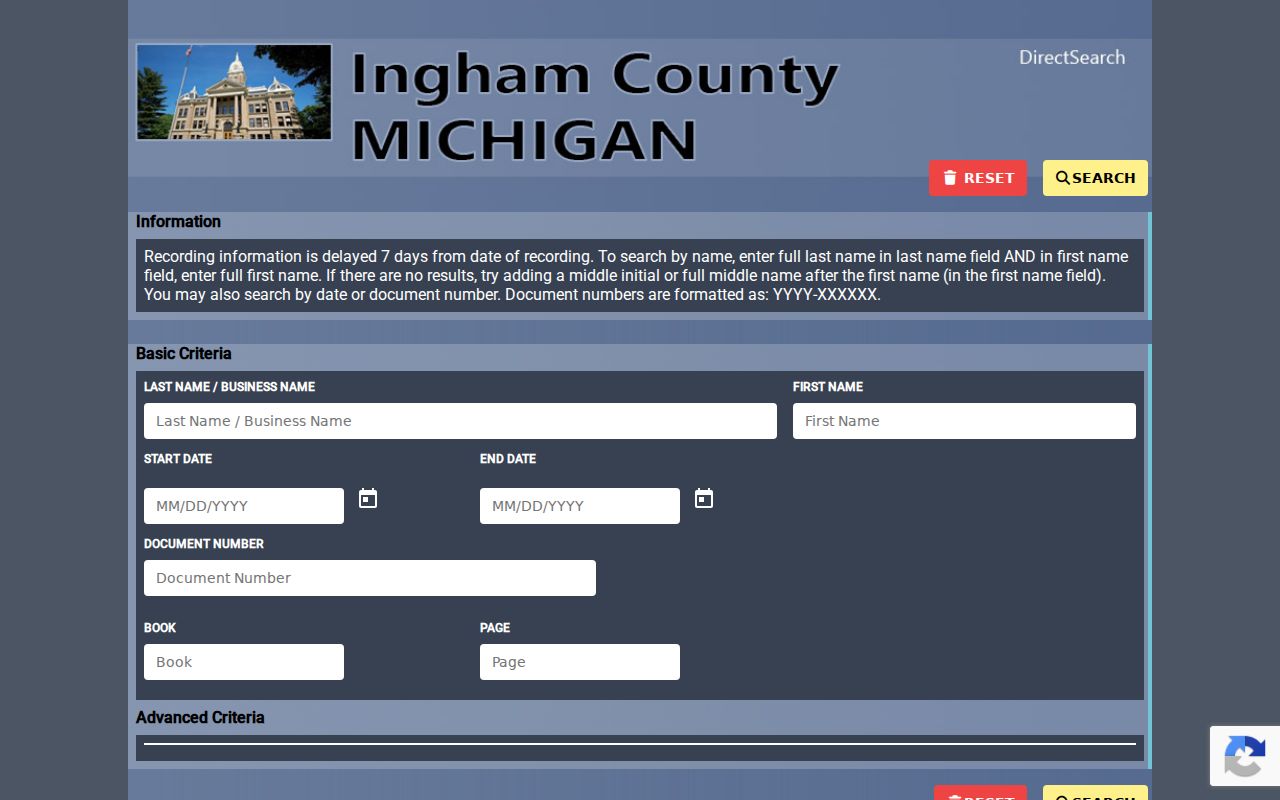
The screen provides the official online route, but an early result still needs a vault check when a discrepancy affects a title trail.
For pre-1960 records or public-computer research, schedule a Mason courthouse vault appointment. The vault is open Monday through Friday from 8:30 a.m. to 4 p.m.; call 517-676-7216. The Register's office is open Monday through Friday from 8 a.m. to 5 p.m., and mail copy requests need a name or property description, book and page, or document number. County copies are $1 per page.
The county's Records Online information explains the free, paid, subscription, and office-copy routes.
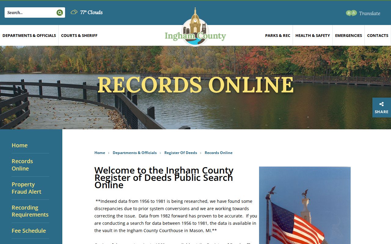
Using the vault and office-copy path is normal Ingham research when a modern street label cannot carry the search back far enough.
Privacy Limits of Ingham Street Directories
A public parcel record does not list every person at a property. It usually centers on owners, taxpayers, and recorded parties. Household members, guests, utility customers, delivery recipients, and many occupants are not a public street source. The federal Driver's Privacy Protection Act restricts ordinary access to DMV addresses. Michigan voter records also withhold fields such as month and day of birth, phone, email, signature, and identity numbers.
Michigan's Address Confidentiality Program, created by 2020 PA 301, allows eligible participants to use a substitute address and receive confidential handling. A protected voter or program participant may not appear at an actual location. Those limits are safeguards, not failures in the Ingham street directory.
Lawful personal research. Use Ingham address records for a legitimate, non-invasive purpose. Michigan stalking law, MCL 750.411h, covers a willful course of repeated harassment that causes fear, intimidation, or distress; public records must never be assembled to facilitate unwanted contact, surveillance, or harm.